Pushing an Ocean Agenda
As
island people we should actively create activities to bring awareness on World
Oceans Day, June 8 (Saturday). Pat Ganase tells us why we have reason to
celebrate.
World
Oceans Day has been observed since 2002; and every year since then, efforts to
make people aware of the underwater world occupying more than 70 % of our
planet have resulted in greater appreciation of seascapes and species; as well
as access to and opportunities to heal the relationship between the land and
the seas. (https://www.worldoceansday.org)
The
ocean is important because it:
·
Generates most of the oxygen we
breathe;
·
Provides food;
·
Regulates the climate;
·
Recycles and cleans the water we
drink;
·
Offers a plentiful supply of
medicines; and
·
Provides limitless inspiration!
Whether you live inland or on the
coast, we are all connected to the ocean. Take time to think about how the
ocean affects you, and how you affect the ocean, and then organize or
participate in activities that celebrate one ocean. This World Oceans Day, we
are encouraged to think about what the ocean means and what it has to offer all
of us; let us pledge to conserve healthy seas for ourselves and our children’s
children.
We can discover the wealth of
diverse and beautiful ocean creatures and habitats, and how our daily actions
affect them. We need to make the changes that are necessary to take care of the
ocean as if it were our own backyard. Small modifications to everyday habits
will make a difference; involve family, friends and community to benefit our island
and our blue planet!
 |
| Rare and endangered branching Elkhorn coral (Acropora palmata) at Breakfast Bay, Charlotteville Photo by Anjani Ganase | The Maritime Ocean Collection |
OCEANS DAY IN TOBAGO
Two very special reasons for celebrating
World Oceans Day 2019 in Tobago are the start of the Maritime Ocean Collection;
and the Government’s assent to the 2018 National Protected Area Systems Plan
for Trinidad and Tobago in which significant ocean areas are protected for the
first time.
The Maritime Ocean Collection will
present online, in innovative 360 degree imagery and videos, the coral reefs
and marine wildlife of coastal Tobago. The operators of the project, the marine
NGO SpeSeas, the Institute of Marine Affairs and dive operators in north-east
and south-west Tobago, have collected underwater imagery that will eventually
be available on a dedicated website to the public, schools, researchers,
visitors. Views and teasers have already been made available on the Facebook
pages of the funders, The Maritime Financial Group, and SpeSeas.
The
National Protected Areas Systems Plan which was approved by the Government of
Trinidad and Tobago in January, has increased near coast protected areas to 14
km2 in Trinidad and 566 km2 in Tobago. In addition, open
ocean waters and deep sea marine areas (OOWDS) under protected status are
15,600 km2, or approximately 22 % of Trinidad and Tobago’s EEZ. These
are areas that have been designated
“sustainable use regions” and their boundaries are outside the blocks
identified for oil and gas exploration: Caribbean Arc SUR. Eastern Caribbean
SUR, Atlantic Ocean SUR and Orinoco-Guyana SUR.
These areas were chosen by the planners to reflect ecosystem diversity,
provide representation across a range of ocean depths and habitats, and ensure
ecological connectivity across these ecosystems.
The Plan has delineated the Northeast
Tobago Marine Protected Area which covers 62 km of coastline mostly fringed by
coral reefs. The types of coral reef communities that occur in the northeast
are very diverse: they vary significantly between the Caribbean and the
Atlantic sides, as well as between the nearshore and offshore reefs.
Charlotteville is home to the rare endangered branching corals, while reefs of
Speyside have an incredible diversity of marine sponges including the large
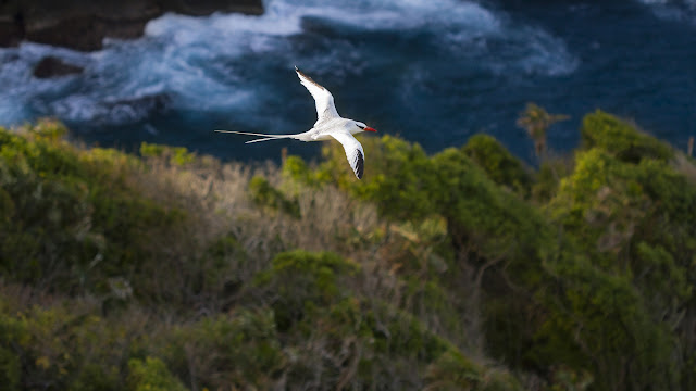
barrel sponges that provide homes for other marine organisms. Many offshore
islands and offshore rocks are beacons for the congregation of bird life above
the water and also for fish and other pelagic life underwater.
 |
| Giant brain coral found along a reef that fringes Little Tobago, Speyside. Photo by Anjani Ganase | The Maritime Ocean Collection |
What is important in this Plan
is the recommendation of nearby coastal and marine sites for protection that
occur outside of the newly designated marine protected area (MPA), such as
Plymouth, Smith’s
Islands and
the Great River Shoal. These additional areas will benefit from and support the
MPA through the exchange of coral and fish larvae that are dependent on current
flow. These stepping-stones of protected areas will help maintain the
sustainability of coastal areas in the long-term. Secure connections
for reseeding of coral and fish life are crucial for recovery from natural
disasters (hurricanes) and especially for a relatively isolated and unique
marine environment such as Tobago.
These are the coastal areas
listed in the Plan:
·
L’Anse
Bateau: coral reef
·
Plymouth:
coral reef
·
Mt
Irvine: turtle nesting
·
Englishman’s
Bay: coral reef, turtle nesting
·
Charlotteville:
coral reef
·
Little
Tobago and Goat Island: seabirds breeding; coral reef
·
Lucy
Vale: wetland
·
Queen’s
Island: seabirds roosting; coral reef
·
Richmond
Islands: coral reef; seabird colony
·
Sisters
Rock: coral reef, seabird nesting
·
Smith’s
Islands: seabirds nesting
·
St
Giles: seabirds
·
Great
River Shoal: coral reef; rocky shores; queen conch habitat
·
King
Peter’s Bay: turtle nesting
·
Great
Courland, Little Courland, Stonehaven Bays: turtle nesting
·
Lambeau
Bay: turtle nesting
·
L’Anse
Fourmi beach: turtle nesting
·
Hermitage
Bay: turtle nesting
·
North-east
Tobago MPA extends for 53,340 ha
·
Buccoo
Reef and Bon Accord lagoon: 2,234 ha (coral reef, mangrove, freshwater marsh,
sea grass beds, habitat for hawksbill turtles and migratory birds)
 |
| School of fish congregate around Sanga Rock, north of Charlotteville. Photo by Anjani Ganase | The Maritime Ocean Collection |
A parallel report, Improving Forest and Protected Area Management in Trinidad and Tobago,
under the auspices of the FAO with funding from the UNDP GEF, deals with the
pathways and people that must be involved in the establishment of the Marine
Protected Area in North-east Tobago. One of the authors of this report,
Aljoscha Wothke, who is already involved in education and conservation
activities, notes:
“The stakeholders in Tobago, especially
those involved in conservation activities, already have quite a clear
understanding of the needs for effective monitoring and primary data
processing.”
The Report states: “The two most
outstanding needs to improve management effectiveness in the NE Tobago MPA are:
community participation in planning and co-management arrangement with strong
civil society organisations, and education / awareness at community and
governmental levels to generate buy-in.”
The
establishment of the MPA presents many opportunities for employment, economic
development and unique conservation-based ecotourism in this remote area of
Tobago with features such as bird sanctuaries on offshore islands and the Main
Ridge Forest Reserve.
We
expect that Northeast Tobago MPA will be such a model of awareness and
conservation that it might demonstrate the rainforest and ocean in perfect
harmony.
References:
Protected Areas Systems Plan for Trinidad
and Tobago
Final
Report of the Marine Protected Area Specialist Team for the project, Improving
Forest and Protected Area Management in Trinidad and Tobago (GCP/TRI/004/GFF)
related to a possible Marine Protected Area in Northeast Tobago