Protecting Land and Marine Reserves Of Tobago
Last week, this column looked at what individuals might do to protect their piece of paradise, their backyards in Tobago. This week, we review some special sites around Tobago that have been identified for national protected status, to be ratified by the Government. Pat Ganase reports.
The National Protected Areas (NPA) Systems Plan for Trinidad and Tobago is complete, and now requires commitment through legislation and resources to be effected. Recommendations for Tobago include 13 terrestrial/ freshwater sites; 22 coastal/ marine areas; and extensive Open-Ocean Waters and Deep-Sea (OOWDS) areas amounting to some 15,600 km2 of the Exclusive Economic Zone (EEZ).
Prior to 1970, there was a utilitarian focus on the natural resources in the marine environment around Trinidad and Tobago. By 1975, the marine area under jurisdiction extended 12 nautical miles beyond the shores; this was pushed to 200 nautical miles in 1984. Today, the Plan seeks to bring some 22% of the EEZ under protection. This OOWDS area includes four distinct Sustainable Use Regions (SUR) – the Caribbean Arc (lying north of Trinidad), the Eastern Caribbean SUR (to the north of Tobago), Orinoco Guyanan SUR (to the east of Trinidad) and the Atlantic Ocean SUR (furthest east in the EEZ) – intended to protect migratory species (whales, sea turtles and birds among others); as well as unique sea-bed biological communities; and to ensure the maintenance of ecological connectivity; all while monitoring and ensuring “wise use” of the resources.
 |
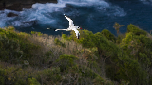
| North facing view from Little Tobago Photo by Anjani Ganase |
At this time, it is noted that the only marine area in Trinidad and Tobago afforded legal protection is the Buccoo Reef Marine Preservation Area established in 1973. The Buccoo Reef MPA was proposed as an environmentally sensitive area (ESA) in 2004, but this has not yet been effected. The Plan proposes to extend the area under protection to the coastline bordering the Buccoo Reef MPA thereafter to be designated the Buccoo Reef and Bon Accord Lagoon, protecting the connectivity between coral reef and mangrove, preserving the country’s largest freshwater marsh, most extensive sea grass beds, and habitat for critically endangered hawksbill turtles and migratory birds.
The Plan also proposes the North East Tobago MPA extending about 10 km from the shore in an arc from Castara around the north-east to Roxborough. This area would cover some 53,340 ha in the country’s Exclusive Economic Zone (EEZ). North East Tobago MPA includes a complex region of offshore islands, coral reefs, sandy beaches, rocky shores, dry forest and habitats for sea birds. This MPA includes/ overlaps specifically identified sanctuaries or reserves including sanctuaries at Little Tobago and Goat Island for breeding seabirds, and coral reefs; L’Anse Bateau with its coral reefs; the Charlotteville coastal coral reefs and habitats; Sisters Rock coral reefs and habitat for seabirds; and the St Giles Island sanctuary for seabirds.
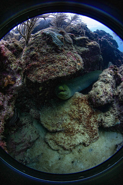
 |
| St Giles Island Photo by Anjani Ganase |
Other areas of marine and coastal Tobago recommended as marine protected areas include: Plymouth for its coral reefs; and Englishman’s Bay for coral reefs and nesting sea turtles. It is recommended that many other coastal ecosystems be designated Habitat/Species Management Reserves. These include Lucy Vale for its wetlands; Queen’s Island for coral reefs and seabirds; Richmond Islands for coral reefs and seabirds; Smith’s Islands for seabirds; and Great River Shoal for coral reefs and habitat for Queen Conch. Additional turtle nesting sites are also proposed for protection; these include King Peter’s Bay, Great Courland, Little Courland and Stonehaven Bays; Lambeau Bay; L’Anse Fourmi Beach; Hermitage Bay.
On land, Tobago has the distinction of the oldest forest reserve in the western hemisphere. The Main Ridge Forest Reserve (4000 ha) was established by royal decree in 1765 to protect the watershed. The area is conserved to keep the forest cover intact; it has developed as a de facto national park with hiking trails, with ecotours to the habitats of significant Tobago flora and fauna managed by an active department of forest wardens and conservators. It is such an iconic location that consideration is being given to designating the forest reserve an environmentally sensitive area (ESA) and world heritage site. Within the Main Ridge can be found the headwaters of the Goldsborough River and important endemic species of Tobago. The new Plan proposes the extension of the Main Ridge Forest Reserve to include the Southern Main Ridge (along the Bloody Bay-Parlatuvier Main Road); and the Northern Main Ridge. Together these areas would double the acreage under protection as the Main Ridge Forest Reserve. Adjacent to the Main Ridge are the Goldsborough and Hillsborough watershed areas, also proposed for protection.
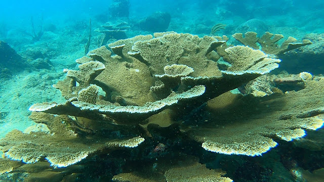
 |
| Angel Reef, Speyside Photo Anjani Ganase |
Some other locations identified for special protected status include:
Flagstaff Hill; Starwood; Fort Granby and Granby Point; Minister River and Bay; Petit Trou and Lowlands; Kilgwyn; Louis d-Or; L’Anse Fourmi and Merchiston.
Proposals for protected status have been endorsed in consultations with the communities. It is clear that in every area of our island, Tobagonians believe that there are natural environmental features to be cherished and protected. Why not just designate all of Tobago and its marine expanse for protected status?