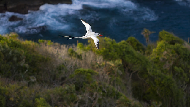
Islands in the Orinoco
To the east of Trinidad and Tobago is the Atlantic,
on the west the Caribbean Sea. However, the most powerful influence of water on these islands might be the fresh waters coming off the South American mainland.
This week, Anjani Ganase, marine biologist, looks at the mighty Orinoco river
whose delta comprises islands many times the size of Trinidad. This feature was first published in the Tobago Newsday on Thursday, December 1, 2016
Follow
Anjani Ganase on twitter: @AnjGanase
“When
Columbus sailed into the Gulf of Paria he had to make sense of two anomalies.
His navigational readings were picking up the earth’s equatorial bulge, and the
Orinoco being in spate meant that the water was fresh. Captivated by the
apparently friendly natives, the exuberant vegetation, the benign climate and
the extraordinary landscape, he called the area Tierra de Gracia (Graceland).”
-John
Stollmeyer, Place of Beginnings, the World Views of the Amerindians of Cairi
and of Medieval Europe, 2003
Columbus
sailed through the Gulf of Paria on 1st August 1498, during his third voyage. It was this occasion that
Trinidad and Tobago also marked as our “discovery day” commemorated in Moruga
by mock landings of Columbus’ caravels, even though it is commonly thought that
Columbus never came ashore.
In
August, at the height of the rainy season, the Gulf of Paria would have seemed
to the explorer a land-locked lake of fresh (sweet) water. Columbus didn’t stay
in the Gulf of Paria but sailed south to the Orinoco delta, the region now
called Amacuro, some 40,000 sq km of swampy forested islands.
Almost
a hundred years later, Sir Walter Raleigh wrote of his 1595 voyage: “…the great
river of Orenoque or Baraquan hath nine branches which fall out on the north
side of his main mouth; on the south side it hath seven other fallings into the
sea … but the islands are very great, many of them as big as the Isle of Wight…
“ He also noted, “between May and September the river of Orenoque riseth 30 foot
upright, and then are those islands overflowen 20 foot high above the level of
the ground.”
Travel
at any time of the year in the delta was necessarily by boat, and Raleigh
wrote, “… these people that dwell upon the branches of the Orenoque, called Capuri
and Macureo, are for the most part carpenters of canoes, for they make the most
and fairest canoes and sell them in Guiana for gold, and into Trinidad for
tabacco.”
 |
|
Warao
children paddle in the Orinoco delta. Photo courtesy Marc de Verteuil who leads tours
up the Orinoco from Trinidad.
|
Raleigh
persevered upriver and “beheld that wonderful breach of waters … more than
20 miles away, and there appeared some ten or twelve overfals in sight,
everyone as high over the other as a church-tower, which fell with that fury,
that the rebound of water made it seem as if it had been all covered over with
a great shower of rain.” One of these mighty waterfalls would have been Angel
Falls, the highest in the world. (Angel
Falls tumbles off Rio Kerepacupai Meru which flows into a tributary of the Carrao River, itself a tributary of the Orinoco.)
Trinidad
and Tobago sits on the continental shelf of South America. Trinidad is 12
kilometres from Venezuela, and Tobago 30 kilometres from Trinidad. Both islands
are geological extensions of the mainland. Trinidad’s Northern Range and
Tobago’s Main Ridge may be the easternmost extensions of a cordillera of the
Andes. It is thought that Trinidad was separated about 11-15,000 years ago. The
flora and fauna of our islands are identical to South American populations. A
couple species that remain specific to the Orinoco are the pink river dolphin
and the endangered Orinoco crocodile (the largartos of Raleigh’s description) which
can grow to twenty feet.
The name Orinoco came from Guarauno words
meaning “a place to paddle,” a place for transportation or navigation by
canoes. It is also uniquely connected to the Amazon by the Casiquiare canal, a
hydrographic divide between the Orinoco Basin and the Amazon Basin.
The Orinoco flows west–north–northeast into the Caribbean;
the Amazon flows east into the western Atlantic in the northeast of Brazil. The Casiquaire is a west-flowing section of
Venezuela's Orinoco River with an outflow into the Amazon Basin.
 |
|
Boat
building in the Orinoco delta.
Photo courtesy Marc de Verteuil who takes tours
up the Orinoco from Trinidad.
|
The
Orinoco basin covers an area of approximately 950,000 km2. It is bordered by
the Andes to the west and north, the Guyana Highlands to the east, and the
Amazon watershed to the south. The river, approximately 2,200 km in length, runs
in an arc and its basin occupies an area that is most of Venezuela and part of
Colombia.
The
Orinoco delta, a region called Amarcuro, is a wide triangle extending about 400
km along the Atlantic coast of Venezuela from Pedernales on the Gulf of Paria
to Punta Barima on the Boca Grande. The river flows into the southern Caribbean
Sea, its waters bathing Trinidad and Tobago.
The
outflow of the Orinoco delta brings a tremendous torrent of freshwater during
the rainy season (usually April to November). These outflows bring many
terrestrial and freshwater species from South America to Trinidad. It is
rich in nutrients, and because it is less dense than seawater, the fresh water
remains at the surface. This plume of waters can be observed, in satellite
images, emanating from the Orinoco delta enveloping Trinidad and Tobago, and
swirling into the Caribbean Sea, as far north as Puerto Rico.
 |
|
Obtained by remote
sensing from space, images like this illustrate biological and physical oceanic
phenomena. In this view, warm colours are high chlorophyll. (From the Goddard Earth
Sciences Data and Information Services Centre NASA)
|
Orinoco
waters are carried around Trinidad and Tobago by what is called the Guiana
Current. Tobago is subjected to the full force of this current which divides at
the southeast coast; one part flowing in a northeasterly direction, and the
other passing between Trinidad and Tobago in a northwesterly direction.
How
do we know the Orinoco is flowing past our islands? When you dive in Tobago waters
and observe the ocean’s green tint, you are seeing increased chlorophyll
concentrations in the fresh water coming off the South American mainland. As
much as we might like to identify as Caribbean islands, our South American connection
is unmistakable.
,_Walking_the_Plank,_from_the_Pirates_of_the_Spanish_Main_series_(N19)_for_Allen_&_Ginter_Cigarettes_MET_DP835032.jpg)