Our Continental Island
Faraaz Abdool considers Trinidad’s connections to South America
As a child, I spent considerable time walking the trail around the pond at the Pointe-a-Pierre Wildfowl Trust. While there, Molly Gaskin, founder and president of the Wildfowl Trust, would impress upon the audience the importance of linkages in the natural world. As the years rolled past, I never forgot her words. In fact, once I began to immerse myself in the wild spaces of our islands and beyond, these linkages only became more apparent. Everything is indeed tied to something else in an elaborate, self-sustaining and incomprehensibly vast web.
Globe-spanning currents of water and air distribute life-giving nutrients. Saharan dust helps to fertilise soil in the Amazon rainforest, which in turn helps to keep ice intact in polar regions. Countless animals migrate using the earth’s magnetic field as guidance, tubers that lie dormant for months know exactly when to send their green shoots skyward to meet the rain. These linkages involve much more than the simplistic eat-or-be-eaten rhetoric of the outdated classroom. A forest, for example, is not merely a random amalgamation of trees, but a functioning, colonial organism – which can also be said of a Portuguese man o’ war. We may not always be able to perceive these linkages, but as our knowledge and understanding grow, so too must our attitudes.

Homes, hills, and our next door neighbour: the western
end of Trinidad’s Northern Range and the eastern end of Venezuela’s Paria
Peninsula are virtually indistinguishable. Photo
courtesy Ziad Joseph
Our ability to navigate our present depends on our ability to recognise and strengthen the linkages that have made our existence possible. As islands, it is understandable for us to feel separated - the region is described as “islands separated by the Caribbean Sea.” This notion of separation helps to alienate the tiny islands of the Caribbean not only from the rest of the world, but from each other. It is imperative for us to look at the ocean not as a body of water that separates islands, but unites them.
Given the tumultuous history of the region, we cannot look to the recent past for guidance. To have an idea of how we can carve a stable and peaceful path forward, we need to examine our history on a geological time scale. Fortunately, this is much easier than it sounds! All around us, there is evidence of a greatly interconnected world that has survived for millennia - what is needed is for us to start conscientiously observing the natural world and all that is within it.
 |
The introductory sentence on this sign at the P-a-P Wildfowl Trust reads “All natural systems are LINKED” Photo by Faraaz Abdool
|
LAND BRIDGE TO THE NORTHERN RANGE
For us on Trinidad, the spectacular Northern Range is a benevolent, familiar presence. For many, the sight of the verdant hills rising above the bustling east-west corridor provides a sense of calmness amid the chaos. The distinctive peak of El Tucuche can even be seen from San Fernando on a clear day. The Northern Range indicates a connection that few of us have managed to hear - it is the northernmost outcrop of the Andes. Also known as the “dragon’s back”, the Andes mountain chain ranges from Patagonia at the southern tip of South America, proceeding north along the western end of the continent before making a sharp right turn into Colombia and Venezuela. The final flourish of the dragon rises from the depths of the rowdy bocas del dragón at Chaguaramas to traverse the width of Trinidad’s north coast.
Trinidad’s status as an island is a fairly recent event, the rising ocean at the end of the last ice age covering the last land bridge, terminating the terrestrial connection. Presently, one can still comfortably wade for around a kilometre along several sandbars at Columbus Bay when the tide is very low. The water along Trinidad’s southern coast is often brown and murky, much of it from the outflow of the extensive Orinoco River. Over thousands of years, this river has taken billions of tons of sediment from inland continental wetlands and deposited its payload in shallow water, helping to create habitats such as the tidal mudflats of Trinidad’s west coast. Knowledge of pre-Columbian times has been passed orally through generations of Indigenous people, whose lifestyle reflected the interconnectedness of the natural world they inhabited. The word “Orinoco” itself is a Warao word meaning “a place to paddle”; the Warao being one of several peoples that inhabited the region.
Warao Shaman Raould Simon at the Smoke Ceremony at
Nabarima Hill, 21st September. Photo
courtesy Raould Simon 
PILGRIMAGE TO NABARIMA
Movement throughout the region was a cornerstone of the survival of indigenous people. Whether for seasonal food, social, or spiritual reasons, people routinely shifted from place to place and borders only involved navigable shorelines and distant horizons. The heavily quarried San Fernando Hill - known as Nabarima Hill to the Warao - for example, is a spiritually significant site that was visited by Warao people from mainland South America up until 1920 when the British prevented the pilgrimage. Today, spiritual practice on the Hill has resumed. “Nabarima Hill aka San Fernando Hill, was always a sacred space for thousands of years to the Warao people of the mainland,” explains Warao Shaman Raould Simon at a recent ceremony on the Hill. His connection with the land runs far beyond; he continues, “when the ice melted it broke us apart. They still used to walk from the mainland to the top of the hill to perform the smoke ceremony, I am just continuing from the ancestors.”

Cagebird fanciers in Trinidad have long pushed the
Grey Seedeater to local extinction, but it continues to survive in the
remainder of its native range: northern South America. Photo by Faraaz Abdool 
Moriche Palms in the protected Aripo Savanna, a
sensitive and threatened ecosystem in east Trinidad. Photo by Faraaz Abdool
Of all the islands of the Caribbean, Trinidad is the only “continental island.” Nowhere is this more apparent than in our flora and fauna. In the prehistoric wet savanna landscape of Los Blanquizales in the southwest and Aripo Savanna in the east, Moriche Palms tower above the treeline. Trinidad is the northernmost range of this South American species that serves a plethora of uses to people and animals. Trinidad is also the only island in the Caribbean with a native feline apex predator: the Ocelot. Nearby Tobago does not share the same geological history, that island instead bears a closer relationship with northwest South America and the dry, rocky islands of Aruba, Bonaire, and Curaçao. Drifting eastward for the last 65 million years, Tobago has a much longer history as an island than Trinidad, despite both islands’ continental origins.

The Copper-rumped Hummingbird was first scientifically
described in Tobago; this common sight around our homes and gardens can only be
experienced in Trinidad, Tobago, and Venezuela. Photo by Faraaz Abdool 
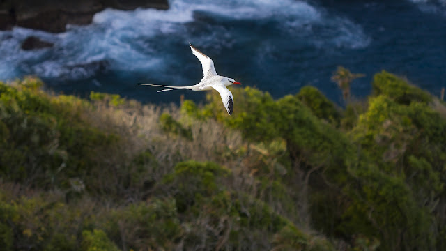
Trinidad is the northernmost extreme of the range of
the Bearded Bellbird, a distinctly South American species. Photo by Faraaz
Abdool
FOLLOW THE BIRDS
Birds are known as ecological indicators, but observing them can also give us clues about the linkages that may not be immediately obvious. Trinidad and Tobago is widely hailed as an introduction to Neotropical birding, and this is only due to the fact that both islands bear a deep connection with the mainland. The next time you see a toucan, motmot, jacamar, or even our national bird the cocrico - they are here because of the shared history with South America.

The coastline of Venezuela as seen from Soldado Rock,
off Trinidad’s southwestern peninsula. Photo by Faraaz Abdool
,_Walking_the_Plank,_from_the_Pirates_of_the_Spanish_Main_series_(N19)_for_Allen_&_Ginter_Cigarettes_MET_DP835032.jpg)