Science on a Boat
Anjani Ganase joins the team to survey coral reefs which innovates a process that allows scientists to monitor the health of corals
The experience on Heron Island working on my master’s research led to the opportunity to map coral reefs of Australia’s Great Barrier Reef (GBR) for the XL Catlin Seaview Survey. This project had two main purposes: outreach, by bringing coral reefs to people using 360-degree imagery to create an immersive learning experience. The second purpose was scientific using the camera technology to create one of the largest visual baselines of the Great Barrier Reef from which researchers extract information on reef composition and study the spatial patterns of this expansive reef system. For me, it was the ultimate dream job. As the marine technician, I was tasked with collecting all the imagery and associated data for all the sites during the four-month excursion from the Southern Great Barrier Reef to the Far North GBR and Coral Sea. It was an ambitious mission to get representative baselines of the GBR and showcase the project and fieldwork to the world. In addition to diving with the team of photographers documenting the marine life, I was required to write blogs about my experience.

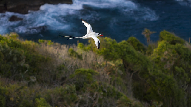
The Great Barrier Reef, Australia.
Credit: Katerina Katopis / Ocean Image Bank
Bon Voyage
It was my first job as a marine scientist and I was very nervous. The responsibility was huge: image collection, making sure the cameras were working, batteries were charged, images downloaded, memory card wiped and cameras sealed for each new day of diving. When we set sail out of Port Douglas, heading straight to the outer reef, I was in the belly of the ship, setting up camera equipment, orienting myself with the computer programmes and the database. The catamaran rocked back and forth gently as the two hulls walked on water, and a wave of nausea hit me. I never thought I would get seasick as it never happened before, and I didn’t want it to begin. I went to the back deck to get some air, and took my laptop with me to keep working, but instead I sat there watching the coastline shrink away until it was just ocean all around. The captain saw me, expressed some concern, but by then the feeling of nausea was replaced with adventure and excitement. I was on a boat heading to the outer Great Barrier Reef, 60 km from the mainland, and over 15,800 km from my homeland of Trinidad and Tobago. We continued to steam throughout the night, and the crew worked day and night. We travelled to each destination by night, and during the day we would take the smaller dive boat out to survey the new reef.

Christophe with the underwater
camera rig called the Seaview II and Anjani as the support diver. Image
courtesy the XL Catlin Seaview Survey | Underwater Earth
Opal Reef
The first couple of days were hectic. We were still working out the best methods for loading and offloading and developing a routine for safe deployment. I remember one dive where Christophe, my boss, was driving the camera rig in front of me and I was on the safety scooter behind him. I had one job, which was not to lose him so I could assist him if there was any issue. My heart was pounding but it was exhilarating to move over the reef with such ease. The first impression of the Northern GBR for me was Opal Reef, a real underwater gem: coral gardens with endless branching coral thickets for hundreds of metres and rich marine life. Fish would follow the scooter, hanging out with us, and as Christophe rounded the bend in the reef, I saw the largest grouper – a Queensland grouper – fly out of a crack in the reef in front of me. It was the size of a small car, and it was between me and Christophe who was zooming ahead, away from me. The grouper decided to follow Christophe, the scooter sounds attracted it, but when it realised that I was behind, it whipped around to follow me. The propulsion of its fins was so strong that I could hear and feel its movement. It looked at me with its gawking eyes and open mouth – like a large shaggy dog waiting to play catch. I sped off as fast as I could but it was still trailing me. So, I stopped and turned around, it kept looking at me engaging me to play. I scooted directly at it to scare it away, and it turned around and swam off. I rounded the corner to catch up with Christophe, only to see him waiting for me looking annoyed. Clearly, he saw none of the interaction, but the grouper eventually returned. This was the start of many underwater adventures and interactions with the marine creatures of the GBR – sharks, mantas, dolphins and hundreds of green turtles – as well as beautiful friendships with the amazing people I worked with and the ship crew that kept us safe over the next months.

Wilson Reef. 360-degree image
stitched together. Photo courtesy the XL Catlin Seaview Survey | Underwater
Earth.
All about the data
We surveyed about 180 reefs from south to the Far Northern Great Barrier Reef, including the Coral Sea reefs - Osprey, Flinders Reef and Myrmidon. Each survey was done with underwater scooters, each with three cameras attached to the head of the scooter. This custom designed scooter-camera for our project allowed us to travel underwater for about 2 km within an hour of survey. We surveyed over 360 kilometres of reef which still is a drop of the bucket considering the Great Barrier Reef is over 300,000 square kilometres. In all, the surveys equated to the full coastal perimeter of Trinidad and Tobago. On every dive, we collected three images (to form a 360-degree image), every three seconds. This meant that for every dive we collected about 3600 pictures across the three cameras. Adding it all up, this was a collection of over 600,000 images over four months that resulted in over 16 terabytes of valuable raw images to be stored, processed, stitched together and analysed.
This took another two years and was a big part of my PhD work, assisting the post doctorate team with extracting the essential information from each image. About 200,000 images needed to be annotated to describe the reef composition, and if this were to be annotated manually, it would take an individual about 12 years to complete, working 12 hours days and not considering weekends or holidays. Essentially, I would still be annotating today in the real-world scenario. Instead, the science team developed an automated AI system to assist with the analysis and we all pitched in to train “the machine” which deployed deep neural networks to become expert in coral identification. So, the expected 12 years of manual annotation were reduced to a couple weeks of automated or semi-automated annotation of the images thanks to the brilliant work of Dr Manuel Gonzalez-Rivero and the team at Scripps Ocean Institute. At this point, the information is ready to derive trends and spatial patterns across the reef, and one year later this is what I did for my PhD when we surveyed the coral reefs of the Caribbean.

Live aboard vessel on the Great
Barrier Reef with the dive boat in tow. Photo courtesy Underwater Earth.
2012 Coral bleaching report
We survey mostly the outer reefs; many fell under different management zones. The impact of management was clear, between recreational fishing areas and fully protected sites, in the amount of fish life. I was blown away by the beauty of most reefs. I was a novice in this world, and did not have the historical experience. This was laid out plainly when a publication was released while we were surveying, by De’ath et al (2012) which stated that long-term monitoring data showed that coral cover on the GBR declined by 50 % from 1985 to 2012. The causes of the decline were cyclones, crown of thorns sea star outbreak related to nutrient pollution, and coral bleaching. The decline was also not evenly distributed across the reef: the Far northern sites which were most remote were not impacted compared to the central parts of the GBR most exposed to human impacts. I needed to adjust my lens and look more closely at the reefs with this information. Years later, the data we collected serve as baselines to coral bleaching and cyclone impacts that continue to degrade the reefs.
,_Walking_the_Plank,_from_the_Pirates_of_the_Spanish_Main_series_(N19)_for_Allen_&_Ginter_Cigarettes_MET_DP835032.jpg)