Technology to protect Buccoo Reef
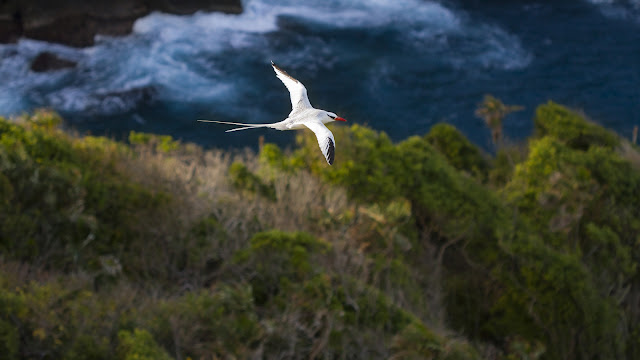
Shivonne Peters, marine scientist, advocates the use of low-cost technology to monitor and protect Marine Protected Areas such as Buccoo Reef. (All photos courtesy Shivonne Peters)
Within the recent year, the Covid-19 pandemic causing government-imposed restrictions, has led to the third closure of the Buccoo Reef Marine Park in Tobago. Every period of closure has prompted the use of innovation and technology to redefine operations and strategies with respect to monitoring and preserving our coastal and marine resources. The question remains, how do we effectively monitor a significantly large marine space and how can we do so at minimal cost? The use of drones or Unmanned Aerial Vehicles (UAVs) has become an increasingly popular tool for aerial photography and videography especially along scenic areas such as beaches and rocky coastlines. But this “eye in the sky” apparatus can certainly be used for monitoring the Marine Park.

Only a few days ago, we were excited to learn about the climate-smart agriculture project led by the Cropper Foundation, using drones for data collection. It is in fact a perfect tool with a variety of applications due to its relatively low-cost, ease of operation and technical capabilities, lightweight and wide operational range. Drones are also capable of acquiring detailed imagery where flora and fauna identification is possible. In other Caribbean countries, drones have been used to map sea turtles, sharks and other marine megafauna and even identify benthic or seafloor habitats. In our case, the use of drones may be the answer to the perennial question, how can we monitor the Marine Park, for conservation purposes and to manage human activities?
Since 2020, there have been significant improvements in the frequency of marine patrols in the Protected Area to now incorporate weekends, public holidays and even periods of closure due to Covid-19 restrictions. Patrols, however, require substantial manpower; on average three patrol officers and resources; a vessel, fuel and other equipment. With only one patrol vessel operational at any given time, this system has gaps with respect to the coverage of this seven km2 space. Imagine, utilizing a drone as the primary mechanism to patrol the Marine Park and conducting multiple flights per day, covering the entire space in a shorter time than it would take a patrol boat to mobilise and criss-cross the area. Based on the preliminary results of a 2020 study and building on best practices in the region and internationally, it’s certainly an avenue that should be explored.

Photo above: Aerial view of Elkhorn coral
Photo below:Elkhorn coral viewed below the surface

The 2020 study, part of an ongoing PhD study at the University of Trinidad and Tobago, was conducted to determine the spatial extent of different habitats within the Buccoo Reef Marine Park. Due to the high resolution of the imagery acquired from even the least sophisticated drones, habitat types such as coral colonies, seagrass beds, sandy areas and mangroves can be easily identified. At lower altitudes (under 50 meters), the level of detail is remarkable as coral types can be identified under optimum conditions due to morphological and environmental characteristics. Data derived from consistent aerial monitoring will allow managers to determine and even forecast seasonal and temporal shifts at the ecosystem level. For instance, the identification of sensitive habitats (such as coral colonies), changes to habitats (such as the expansion of seagrass in the Nylon Pool) and changes in the use of these habitats (for example feeding habits of marine mammals) can be monitored using drones.
Using drones for monitoring purposes can also assist in detecting illegal fishing and poaching activities within the Marine Park. Poaching typically takes place during the early morning period when there are limited patrols. Pre-programmed drone flights during these critical times can identify instances of poaching. In cases where such activity is observed from the aerial imagery, patrol officers and other enforcement agencies can be dispatched; this will save time and deploy resources with efficiency. It is applicable as an enforcement tool for other regulations such as the ban on use of jet skis in the Marine Park and unauthorized anchoring of vessels. In a very practical sense, the use of drones can be employed as a first line of defence in the protection of the Buccoo Reef.


In fact, the drone use goes beyond coral reef management. Researchers in Trinidad and Tobago are undertaking projects to map large mangrove habitats using aerial imagery. Dense mangrove forests can be monitored on a regular basis to detect threats such as species loss whether by natural or man-made causes. In Tobago, the use of drones may be used to monitor shoreline changes over time due to erosion and as a tool to aid decision-making with respect to stabilization measures. For turtle conservation, drones can be deployed along nesting beaches, affording coverage of a wider zone. Advanced UAV models also have night vision capabilities which could be especially useful in identifying nesting sites and illegal poaching activities. Imagery from drones may also be used in education and awareness programmes, which can be used in tandem with other ground breaking projects such as the Maritime Ocean Collection 360° imagery of the Tobago’s reefs. Consider the array of possibilities for drone use in Trinidad and Tobago!
As countries around the world grapple with the effects of the pandemic, we - a small island developing state - have a unique advantage, to capitalise our Blue Economy. The key will be learning to strike a balance between exploitation and preservation of our ocean resources towards economic growth and enhanced livelihoods. The promotion of nature-based tourism and co-management approaches led by governmental, non-governmental organisations and community groups is visible through the Man and the Biosphere designation, coral restoration projects in Charlotteville and the Castara sustainable tourism model. Our present situation is advantageous. We, as a country, stand at the cusp of transformation, where technological investments, such as the use of drones, can provide useful tools for monitoring, managing and protecting the island’s marine resources.
About the Author: Shivonne M. Peters is a PhD candidate in Marine Sciences at the University of Trinidad and Tobago. Her thesis focuses on the development of a Marine Spatial Plan for the Buccoo Reef Marine Park. For further information email sevenenvironmental@hotmail.com.
Reference:
The Cropper Foundation Project-http://thecropperfoundation.org/portfolio/making-agriculture-profitable-and-sustainable-maps/
,_Walking_the_Plank,_from_the_Pirates_of_the_Spanish_Main_series_(N19)_for_Allen_&_Ginter_Cigarettes_MET_DP835032.jpg)